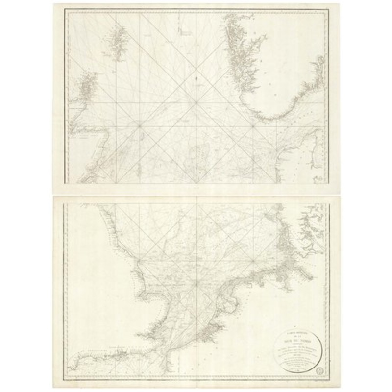
Paris, 1797. Two sheets, each 620 x 940mm, total if joined 1220 x 940mm. A large and detailed French chart of the North Sea, showing the British Coast from Dartmouth to Caithness and the Orkneys and Shetland Islands, and the continental coastline from Abbe
Paris, 1797. Two sheets, each 620 x 940mm, total if joined 1220 x 940mm. A large and detailed French chart of the North Sea, showing the British Coast from Dartmouth to Caithness and the Orkneys and Shetland Islands, and the continental coastline from Abbeville east to Denmarkand the Kattegat, and Norway from Oslo (Christiana) to Bergen. At the time of publication Britain was facing France in the War of the First Coalition. The French alliance with Spain made an invasion of England more likely, but was prevented by John Jervis’s victory over the Spanish fleet at the Battle of St Vincent. 1797 also saw the two naval mutinies at Spithead and the Nore. Such was the danger of invasion that only the ringleaders of the Nore muntiny were dealt with harshly: most of the sailors went unpunished and continued serving in the navy.
Dimensions940 1220 mmCartographerDEPOT GENERAL DE LA MARINE.Date1797PublicationParis, 1797. Two sheets, each 620 x 940mm, total if joined 1220 x 940mm.ConditionA good example.
| Design Period | Before 1890 |
|---|---|
| Year | 1797 |
| Production Period | Before 1890 |
| Country of Manufacture | Denmark |
| Style | Vintage |
| Detailed Condition |
Good This vintage/antique item may have some wear such as scratches and other signs of ageing. |
| Product Code | ZHV-2150207 |
| Materials | Paper |
| Color | Beige |
| Weight Range | Standard Between 40kg and 80kg |
| Duties Notice | Import duty is not included in the prices you see online. You may have to pay import duties upon receipt of your order. |


39 Martin Luther King, Junior Memorial Expressway, Tulsa, Oklahoma 74013, United States
Email:[email protected]

Reviews
There are no reviews yet.