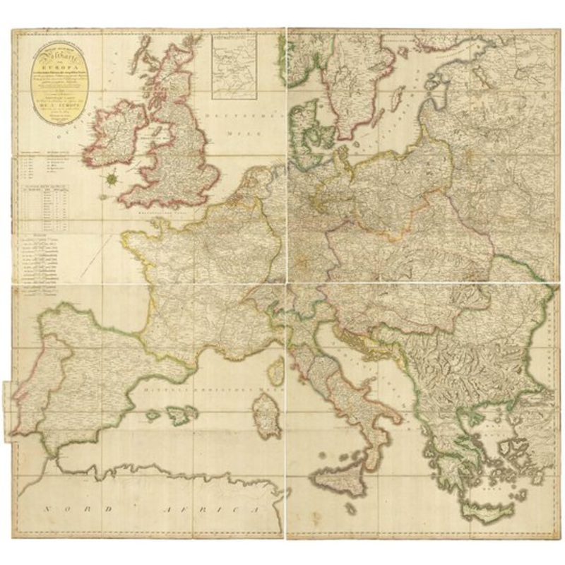
Vienna: Tranquillo Mollo, 1806. Original colour. Dissected and laid on linen in four separate sections, total size if joined 2920mm x 3160mm. A monumental map of the post roads of Europe, showing the British Isles, the Baltic and St Petersburg (with an ins
Vienna: Tranquillo Mollo, 1806. Original colour. Dissected and laid on linen in four separate sections, total size if joined 2920mm x 3160mm. A monumental map of the post roads of Europe, showing the British Isles, the Baltic and St Petersburg (with an inset extending to Moscow), Constantinople, Western Turkey and the Mediterranean west of Rhodes. Published during the Napoleonic Wars, it was meticulously compiled by J?nos Pangr?tz, a Hungarian military cartographer of the Imperial Artillery Regiment.
Dimensions3160 2920 mmCartographerPONGRATZ, Janos.Date1806Extra InfoNeueste Allgemeine Postkarte von Europa in welcher samtliche Postrouten aller europaischen StaatenPublicationVienna: Tranquillo Mollo, 1806. Original colour. Dissected and laid on linen in four separate sections, total size if joined 2920mm x 3160mm.ConditionA good example.
| Design Period | Before 1890 |
|---|---|
| Year | 1806 |
| Production Period | Before 1890 |
| Country of Manufacture | Hungary |
| Style | Vintage |
| Detailed Condition |
Good This vintage/antique item may have some wear such as scratches and other signs of ageing. |
| Product Code | ZHV-2150178 |
| Materials | Linen |
| Color | Beige |
| Weight Range | Standard Between 40kg and 80kg |
| Duties Notice | Import duty is not included in the prices you see online. You may have to pay import duties upon receipt of your order. |


39 Martin Luther King, Junior Memorial Expressway, Tulsa, Oklahoma 74013, United States
Email:[email protected]

Reviews
There are no reviews yet.